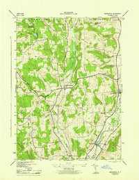
1945 Map of Brookfield
USGS Topo · Published 1945About this map
Brookfield serves as the central hub of this mid-century landscape, where the rural character of Madison County is defined by a network of creek valleys and upland hills. The Unadilla River forms a natural eastern boundary, winding past Leonardsville and West Edmeston, while Beaver Creek carves a path through the center of the quadrangle. This 1940s mapping, conducted by the War Department and the Tennessee Valley Authority, captures a snapshot of a farming economy organized around small schoolhouses like Waterman Sch and School No. 7. Numerous family-named burial grounds, including Clarke Cem and Gorton Cem, are scattered across the terrain near Witter Hill and Button Hill, providing essential data points for local genealogists and historians. The presence of the Fairgrounds just north of Brookfield highlights the town's importance as a gathering place for the surrounding agricultural community.
Find a feature on this map
38 named features on this map. Tap any name to fly to it.
Don’t see what you’re looking for? This feature index may not catch every label — zoom into the map to look around manually.
Map Details
Editions of this 1945 Brookfield Map
This is the sole edition of this map. No revisions or reprints were ever made.
Other maps of this area

1907 · Winfield
USGS Topo · 1:62,500

1907 · Sangerfield
USGS Topo · 1:62,500

1910 · Hartwick
USGS Topo · 1:62,500

1910 · New Berlin
USGS Topo · 1:62,500

1912 · New Berlin
USGS Topo · 1:62,500

1912 · Hartwick
USGS Topo · 1:62,500

1943 · New Berlin North
USGS Topo · 1:24,000

1943 · Hubbardsville
USGS Topo · 1:24,000

1943 · Cassville
USGS Topo · 1:24,000

1943 · Unadilla Forks
USGS Topo · 1:24,000