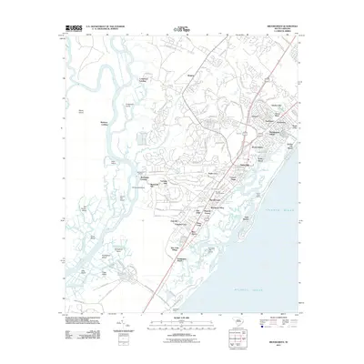
2011 Map of Brookgreen
USGS Topo · Published 2011About this map
Garden City Beach and the developed shoreline of the Atlantic coast stand in sharp contrast to the sprawling wetlands of the Waccamaw River in this 2011 survey. The landscape is defined by the transition from the densely settled communities of Garden City and Murrells Inlet to the protected natural expanse of Huntington State Park. Inland, the map reveals a complex network of coastal islands such as Sandy Island and Vaux Island, separated by a labyrinth of waterways including Collins Creek and Silver Creek. This geographic divide highlights the local reliance on both the oceanfront and the riverine interior. Cultural landmarks and older landings, such as Wachesaw Landing and Mulberry Landing, point to the area's long-standing connection to the river for transport and commerce, while modern developments like Mount Gilead and Ocean Pines mark the more recent suburban expansion.
Find a feature on this map
127 named features on this map. Tap any name to fly to it.
Don’t see what you’re looking for? This feature index may not catch every label — zoom into the map to look around manually.
Map Details
Editions of this 2011 Brookgreen Map
This is the sole edition of this map. No revisions or reprints were ever made.
Other maps of this area

1937 · Myrtle Beach
USGS Topo · 1:48,000

1940 · Myrtle Beach
USGS Topo · 1:62,500

1942 · Magnolia Beach
USGS Topo · 1:24,000

1942 · Waverly Mills
USGS Topo · 1:24,000

1943 · Yauhannah
USGS Topo · 1:24,000

1943 · Bucksville
USGS Topo · 1:24,000

1943 · Brookgreen
USGS Topo · 1:24,000

1943 · Plantersville
USGS Topo · 1:24,000

1949 · Georgetown
USGS Topo · 1:250,000

1967 · Georgetown
USGS Topo · 1:250,000
Featured Places
- Garden City Beach, SC
- Murrells Inlet, SC
- Mulberry Landing, SC
- Wachesaw Landing, Murrells Inlet
- Longwood Landing, SC