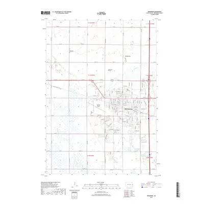
2017 Map of Brookings
USGS Topo · Published 2017About this map
Brookings sits at the heart of this landscape, anchored by the sprawling campus of South Dakota State University. The city is surrounded by a dense grid of section roads like County Road 46 and County Road 77, which cut across the glacial landforms of the Coteau des Prairies. Along the western edge, the Big Sioux River meanders southward, joined by tributaries such as Sixmile Creek and N Deer Creek.
Find a feature on this map
63 named features on this map. Tap any name to fly to it.
Don’t see what you’re looking for? This feature index may not catch every label — zoom into the map to look around manually.
Map Details
Editions of this 2017 Brookings Map
This is the sole edition of this map. No revisions or reprints were ever made.
Other maps of this area

1953 · Watertown
USGS Topo · 1:250,000

1958 · Watertown
USGS Topo · 1:250,000

1964 · Brookings
USGS Topo · 1:24,000

1964 · Medary
USGS Topo · 1:24,000

1964 · Flandreau NW
USGS Topo · 1:24,000

1964 · Aurora
USGS Topo · 1:24,000

1968 · Brookings NE
USGS Topo · 1:24,000

1968 · Bruce
USGS Topo · 1:24,000

1968 · Volga
USGS Topo · 1:24,000
1968 · Rutland NW
USGS Topo · 1:24,000