
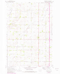
1968 Map of Brookings NE
USGS Topo · Published 1970About this map
The Big Sioux River carves through the northwestern corner of this Brookings County landscape, followed closely by the corridor of the Chicago and North Western railroad. This 1968 field-checked survey reveals a rural prairie environment organized by the townships of Eureka, Sterling, and Afton. The land is defined by the drainage of North Deer Creek and Deer Creek, where early local infrastructure like the Townhall and several Gravel Pit operations supported the agricultural community.
Find a feature on this map
14 named features on this map. Tap any name to fly to it.
Don’t see what you’re looking for? This feature index may not catch every label — zoom into the map to look around manually.
Map Details
Editions of this 1968 Brookings NE Map
2 editions found
Other maps of this area

1953 · Watertown
USGS Topo · 1:250,000

1958 · Watertown
USGS Topo · 1:250,000

1964 · Brookings
USGS Topo · 1:24,000

1964 · Aurora
USGS Topo · 1:24,000

1968 · Bruce
USGS Topo · 1:24,000

1968 · Volga
USGS Topo · 1:24,000

1970 · White
USGS Topo · 1:24,000

1970 · Estelline SE
USGS Topo · 1:24,000

1970 · Estelline
USGS Topo · 1:24,000

1970 · Toronto
USGS Topo · 1:24,000