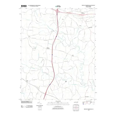
2010 Map of Brooks Crossroads
USGS Topo · Published 2010About this map
Eagle Mills and the surrounding crossroads communities of Iredell and Yadkin counties are documented in this 2010 survey, showcasing a landscape defined by small-town hubs and agricultural drainages. The map traces the winding paths of North Little Hunting Creek and Hunting Creek, which historically supported the milling operations that gave the area its name. Local genealogists will find significant value in the distribution of family-centered landmarks and community burial grounds, including Asbury Cemetery, Shiloh Cemetery, and Zion Cemetery.
Find a feature on this map
92 named features on this map. Tap any name to fly to it.
Don’t see what you’re looking for? This feature index may not catch every label — zoom into the map to look around manually.
Map Details
Editions of this 2010 Brooks Crossroads Map
This is the sole edition of this map. No revisions or reprints were ever made.
Other maps of this area

1891 · Yadkinville
USGS Topo · 1:125,000

1893 · Statesville
USGS Topo · 1:125,000

1893 · Yadkinville
USGS Topo · 1:125,000

1953 · Charlotte
USGS Topo · 1:250,000

1953 · Winston-Salem
USGS Topo · 1:250,000

1954 · Charlotte
USGS Topo · 1:250,000

1955 · Winston-Salem
USGS Topo · 1:250,000

1960 · Charlotte
USGS Topo · 1:250,000

1962 · Winston-Salem
USGS Topo · 1:250,000

1962 · Charlotte
USGS Topo · 1:250,000