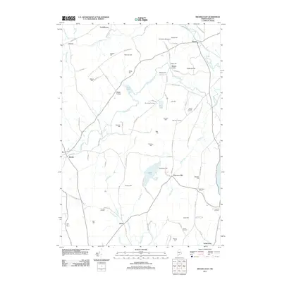
2011 Map of Brooks East
USGS Topo · Published 2011About this map
Marsh Stream and its north branch carve through the heart of this Maine landscape, defining the layout of local crossroads and historical hamlets. The terrain is marked by a series of prominent elevations named for local families, including Robertson Mountain, Dolloff Hill, and Marden Hill. These ridges dictated the path of historical travel, with routes like Monroe Hwy and Jackson Rd connecting scattered settlements such as North Monroe, Pattee Corner, and Monroe Center.
Find a feature on this map
95 named features on this map. Tap any name to fly to it.
Don’t see what you’re looking for? This feature index may not catch every label — zoom into the map to look around manually.
Map Details
Editions of this 2011 Brooks East Map
This is the sole edition of this map. No revisions or reprints were ever made.
Other maps of this area

1900 · Bucksport
USGS Topo · 1:62,500

1902 · Bucksport
USGS Topo · 1:62,500

1902 · Castine
USGS Topo · 1:62,500

1904 · Castine
USGS Topo · 1:62,500

1905 · Penobscot Bay
USGS Topo · 1:125,000

1915 · Belfast
USGS Topo · 1:62,500

1917 · Belfast
USGS Topo · 1:62,500

1932 · Brooks
USGS Topo · 1:62,500

1941 · Belfast
USGS Topo · 1:62,500

1941 · Castine
USGS Topo · 1:62,500