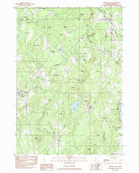
1982 Map of Brooks East
USGS Topo · Published 1983About this map
Nickerson Mills and the surrounding high ground of Waldo County define this late twentieth-century landscape, where timber and agriculture shaped local settlement patterns. The Belfast and Moosehead Lake RR cuts through the western portion of the region, passing through Brooks as it follows the drainage of Marsh Stream. This corridor represents a vital historical link for the small communities of Monroe, Jackson, and Waldo, connecting the interior to the coastal markets of Penobscot Bay.
Find a feature on this map
64 named features on this map. Tap any name to fly to it.
Don’t see what you’re looking for? This feature index may not catch every label — zoom into the map to look around manually.
Map Details
Editions of this 1982 Brooks East Map
This is the sole edition of this map. No revisions or reprints were ever made.
Other maps of this area

1900 · Bucksport
USGS Topo · 1:62,500

1902 · Bucksport
USGS Topo · 1:62,500

1902 · Castine
USGS Topo · 1:62,500

1904 · Castine
USGS Topo · 1:62,500

1905 · Penobscot Bay
USGS Topo · 1:125,000

1915 · Belfast
USGS Topo · 1:62,500

1917 · Belfast
USGS Topo · 1:62,500

1932 · Brooks
USGS Topo · 1:62,500

1941 · Belfast
USGS Topo · 1:62,500

1941 · Castine
USGS Topo · 1:62,500