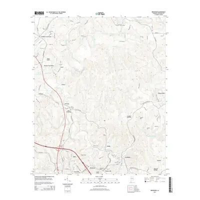
2014 Map of Brookside
USGS Topo · Published 2014About this map
Brookside and the industrial corridors of northern Jefferson County appear here as they were in the early twenty-first century. The landscape is defined by the winding course of the Locust Fork and its tributaries, including Cane Cr and Fivemile Cr. This area is dense with historical communities such as Linn Crossing, Blossburg, Cardiff, and Sayre, many of which developed around the region's mining and railway heritage.
Find a feature on this map
105 named features on this map. Tap any name to fly to it.
Don’t see what you’re looking for? This feature index may not catch every label — zoom into the map to look around manually.
Map Details
Editions of this 2014 Brookside Map
This is the sole edition of this map. No revisions or reprints were ever made.
Other maps of this area

1889 · Birmingham
USGS Topo · 1:125,000

1892 · Birmingham
USGS Topo · 1:125,000

1893 · Jasper
USGS Topo · 1:125,000

1895 · Birmingham
USGS Topo · 1:125,000
1904 · Birmingham Coal District
USGS Topo · 1:62,500
1906 · Birmingham Special
USGS Topo · 1:62,500
1907 · Birmingham
USGS Topo · 1:125,000
1935 · Port Birmingham
USGS Topo · 1:48,000
1938 · Port Birmingham
USGS Topo · 1:62,500
1949 · Sipsey
USGS Topo · 1:24,000