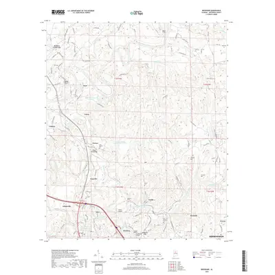
2018 Map of Brookside
USGS Topo · Published 2018About this map
Locust Fork snakes through the northern reaches of this landscape, anchoring a region defined by its industrial legacy and scattered mining settlements. The geography here is a dense network of hollows and ridges, where places like Blossburg, Pinkney City, and Brookside emerged alongside the resource extraction of the Warrior Coal Basin. This 2018 perspective shows the modern footprint of historical sites, including the Jefferson Tunnel and the large Chetopa Mine Impoundment Number 2. The map provides essential detail for researchers tracing the evolution of these communities, showing the proximity of early 20th-century settlements like Cardiff and Sayre to the vital transportation corridors of Fivemile Creek and the Old US Hwy 78. Local history is preserved in the numerous family and community burial grounds, such as Linns Crossing Cem and the Saint Michaels Cem, which remain as fixed points while the surrounding towns of Adamsville and Graysville continue to evolve.
Find a feature on this map
121 named features on this map. Tap any name to fly to it.
Don’t see what you’re looking for? This feature index may not catch every label — zoom into the map to look around manually.
Map Details
Editions of this 2018 Brookside Map
This is the sole edition of this map. No revisions or reprints were ever made.
Other maps of this area

1889 · Birmingham
USGS Topo · 1:125,000

1892 · Birmingham
USGS Topo · 1:125,000

1893 · Jasper
USGS Topo · 1:125,000

1895 · Birmingham
USGS Topo · 1:125,000

1904 · Birmingham Coal District
USGS Topo · 1:62,500

1906 · Birmingham Special
USGS Topo · 1:62,500

1907 · Birmingham
USGS Topo · 1:125,000

1935 · Port Birmingham
USGS Topo · 1:48,000

1938 · Port Birmingham
USGS Topo · 1:62,500

1949 · Sipsey
USGS Topo · 1:24,000