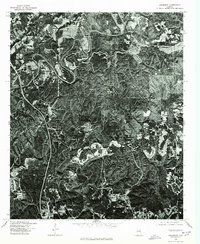
1975 Map of Brookside
USGS Topo · Published 1977About this map
Industrial and residential patterns in the north-central Alabama coal fields are revealed through this 1975 aerial perspective. The landscape around Brookside and Sayre is characterized by the complex relief of the Warrior Basin, where traditional community footprints contrast with the large-scale land disturbances of surface mining operations. These orthophotoquads, produced by the United States Geological Survey in cooperation with the Soil Conservation Service, provide a literal visual record of the region's topography and land use just before the late 1970s. The dense forest cover is punctuated by clearings for the Adamsville vicinity and several winding river valleys that have historically dictated the placement of rail lines and mining settlements. This imagery serves as a critical primary source for researchers studying the mid-century evolution of Jefferson County's mining infrastructure and the physical environmental changes wrought by industrial activity.
Find a feature on this map
3 named features on this map. Tap any name to fly to it.
Don’t see what you’re looking for? This feature index may not catch every label — zoom into the map to look around manually.
Map Details
Editions of this 1975 Brookside Map
This is the sole edition of this map. No revisions or reprints were ever made.
Other maps of this area

1889 · Birmingham
USGS Topo · 1:125,000

1892 · Birmingham
USGS Topo · 1:125,000

1893 · Jasper
USGS Topo · 1:125,000

1895 · Birmingham
USGS Topo · 1:125,000

1904 · Birmingham Coal District
USGS Topo · 1:62,500

1906 · Birmingham Special
USGS Topo · 1:62,500

1907 · Birmingham
USGS Topo · 1:125,000

1935 · Port Birmingham
USGS Topo · 1:48,000

1938 · Port Birmingham
USGS Topo · 1:62,500

1949 · Sipsey
USGS Topo · 1:24,000