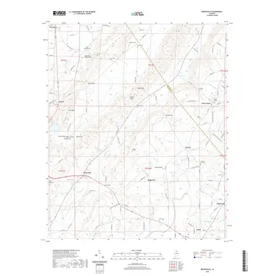
2020 Map of Brooksville
USGS Topo · Published 2020About this map
Sand Mountain dominates the landscape of this Blount and Marshall County border region, where the Tennessee Valley Divide separates north-flowing waters from the southern drainage systems. The map reveals a high concentration of family and community burial grounds, such as Summit Cem, Alldredge Cem, and Nixons Chapel Cem, which anchor the small settlements that dot the plateau and valleys. The southern portion of the quadrangle is defined by the Locust Fork of the Black Warrior River, fed by numerous tributaries including Booker Br and Big Spring Cr. Small crossroads like Brooksville, McLarty, and Snead serve as the primary nodes of habitation. Geographic features such as Cold Springs Gap, Hobson Gap, and Gilbreth Gap provide essential passage through the elevated terrain of Dividing Ridge, illustrating how the physical relief of the mountain has historically dictated the path of local roads and settlement patterns.
Find a feature on this map
121 named features on this map. Tap any name to fly to it.
Don’t see what you’re looking for? This feature index may not catch every label — zoom into the map to look around manually.
Map Details
Editions of this 2020 Brooksville Map
This is the sole edition of this map. No revisions or reprints were ever made.
Other maps of this area

1885 · Gadsden
USGS Topo · 1:125,000

1888 · Cullman
USGS Topo · 1:125,000

1888 · Gadsden
USGS Topo · 1:125,000

1892 · Cullman
USGS Topo · 1:125,000

1892 · Gadsden
USGS Topo · 1:125,000

1895 · Gadsden
USGS Topo · 1:125,000

1903 · Gadsden
USGS Topo · 1:125,000

1936 · Guntersville
USGS Topo · 1:24,000

1936 · Hulaco
USGS Topo · 1:24,000

1936 · Arab
USGS Topo · 1:24,000