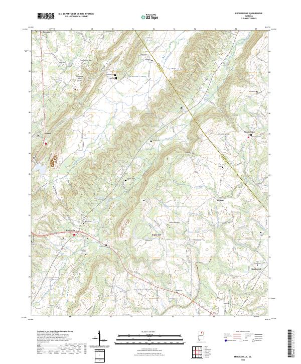
2024 Map of Brooksville
USGS Topo · Published 2024About this map
Sand Mountain dominates the center of this terrain, where the Tennessee Valley Divide separates north-flowing waters like Browns Creek from the drainage basins of Big Spring Creek and Locust Fork to the south. The landscape is defined by its deep gaps and ridges, including Hobson Gap, Cox Gap, and Gilbreth Gap, which have historically funneled travel through this part of the Blount CO and Marshall Co borderlands. Small communities such as Brooksville, Bright Star, and Nixon Chapel are scattered across the valleys and mountain plateaus, often centered around long-standing family and community burial grounds.
Find a feature on this map
132 named features on this map. Tap any name to fly to it.
Don’t see what you’re looking for? This feature index may not catch every label — zoom into the map to look around manually.
Map Details
Editions of this 2024 Brooksville Map
This is the sole edition of this map. No revisions or reprints were ever made.
Other maps of this area

1885 · Gadsden
USGS Topo · 1:125,000

1888 · Cullman
USGS Topo · 1:125,000

1888 · Gadsden
USGS Topo · 1:125,000

1892 · Cullman
USGS Topo · 1:125,000

1892 · Gadsden
USGS Topo · 1:125,000

1895 · Gadsden
USGS Topo · 1:125,000

1903 · Gadsden
USGS Topo · 1:125,000

1936 · Guntersville
USGS Topo · 1:24,000

1936 · Hulaco
USGS Topo · 1:24,000

1936 · Arab
USGS Topo · 1:24,000