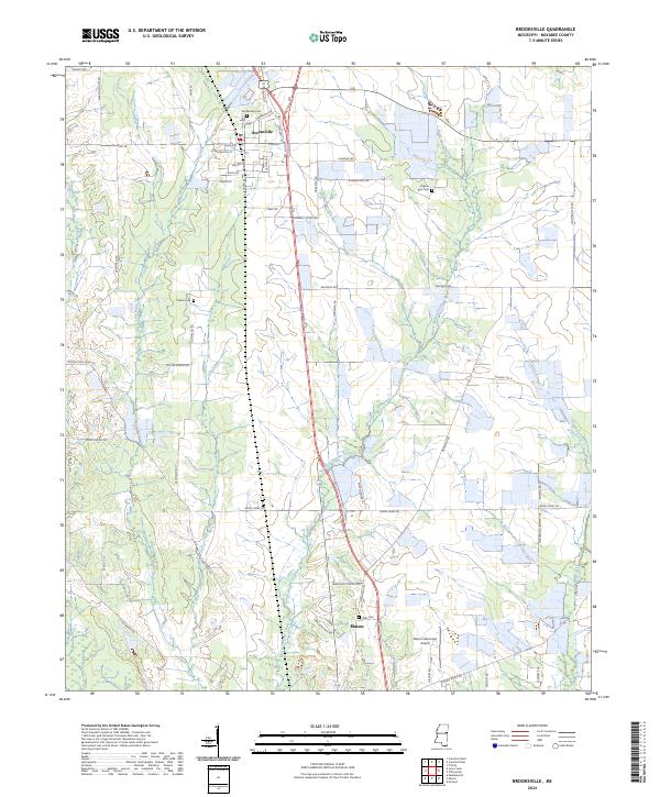
2024 Map of Brooksville
USGS Topo · Published 2024About this map
Brooksville and northern Macon anchor this portrait of eastern Mississippi, where the landscape is defined by the winding paths of Horse Hunters Creek and Wet Water Creek. The settlement pattern follows a grid of township lines and local roads like Old Macon Rd and Macon Lynn Creek Rd, revealing the agricultural layout of Noxubee County. Local history is preserved in small landmarks and community centers such as Toliver Chapel Ch and several family or community burial grounds, including Brooksville Cem and Pilgrim Rest Cem. Near the southern edge, the Macon Municipal Airport sits alongside Dantzler Park Rd, while the northern portion of the map shows the transition from the town center of Brooksville out toward more isolated rural holdings. The presence of numerous named drainages like Plum Creek and Joes Creek underscores the importance of the local watershed in shaping the development and parceling of this prairie region.
Find a feature on this map
65 named features on this map. Tap any name to fly to it.
Don’t see what you’re looking for? This feature index may not catch every label — zoom into the map to look around manually.
Map Details
Editions of this 2024 Brooksville Map
This is the sole edition of this map. No revisions or reprints were ever made.
Other maps of this area

1953 · West Point
USGS Topo · 1:250,000

1958 · West Point
USGS Topo · 1:250,000

1959 · Artesia
USGS Topo · 1:62,500

1960 · Columbus
USGS Topo · 1:62,500

1963 · West Point
USGS Topo · 1:250,000

1973 · Cliftonville
USGS Topo · 1:24,000

1973 · McLeod
USGS Topo · 1:24,000
1973 · Brooksville
USGS Topo · 1:24,000
1973 · Mashulaville
USGS Topo · 1:24,000
1973 · Lynn Creek
USGS Topo · 1:24,000