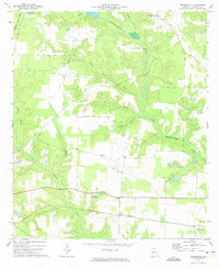
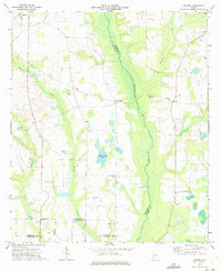
1972 Map of Brooksville
USGS Topo · Published 1974About this map
Brooksville and the surrounding Randolph County countryside are defined by a network of dendritic creek branches and rural institutions in the early 1970s. The landscape is oriented around the Central of Georgia railroad corridor, which links the community of Shellman to the surrounding agricultural land. Local life and genealogy are anchored by numerous country churches, including Trinity Ch, Mt Zion Ch, and Union Grove Ch, alongside the recreational grounds of Camp Okitayakahı. The intricate drainage system of Little Ichawaynochaway Creek and its many named tributaries, such as Collins Mill Creek and Cottonhouse Branch, suggests a terrain shaped by generations of milling and small-scale farming. In the northwest, the Seaboard Coast Line passes through Benevolence, marking the edge of a district where rail and water once dictated the pace of development.
Find a feature on this map
23 named features on this map. Tap any name to fly to it.
Don’t see what you’re looking for? This feature index may not catch every label — zoom into the map to look around manually.
Map Details
Editions of this 1972 Brooksville Map
This is the sole edition of this map. No revisions or reprints were ever made.
Other maps of this area

1953 · Dothan
USGS Topo · 1:250,000

1954 · Dothan
USGS Topo · 1:250,000

1955 · Dothan
USGS Topo · 1:250,000

1972 · Parrott
USGS Topo · 1:24,000
1972 · Benevolence
USGS Topo · 1:24,000

1972 · Shellman
USGS Topo · 1:24,000
1972 · County Line
USGS Topo · 1:24,000
1972 · Cuthbert
USGS Topo · 1:24,000

1973 · Martins Crossroads
USGS Topo · 1:24,000
1973 · Doverel
USGS Topo · 1:24,000