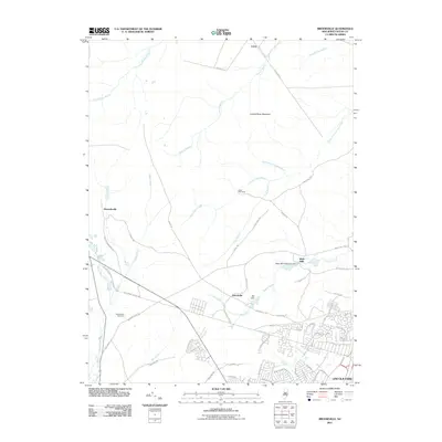
2011 Map of Brookville
USGS Topo · Published 2011About this map
Oyster Creek and the Oswego River define the watery landscape of this Ocean County corridor, where the legacy of early industry remains visible through sites like Wells Mills and the Mill Dam near Brookville. The map illustrates a transition from the dense residential developments of Lincoln Park to the quieter, stream-cut woods further west. Historical footprints are preserved in the path of the Old Railroad and the remote Reevestown Cemetery, tucked away south of Warren Grove Rd. The terrain is characterized by numerous seasonal and perennial branches, including Chamberlain Branch and Factory Branch, which flow toward the coast. Significant landmarks such as Forked River Mountain and Good Will Camp provide a sense of the area's geography beyond the growing street grids, while roads like Old Cedar Bridge Rd hint at long-established transit routes through the Jersey pines.
Find a feature on this map
67 named features on this map. Tap any name to fly to it.
Don’t see what you’re looking for? This feature index may not catch every label — zoom into the map to look around manually.
Map Details
Editions of this 2011 Brookville Map
This is the sole edition of this map. No revisions or reprints were ever made.
Other maps of this area

1884 · Whitings
USGS Topo · 1:62,500

1888 · Barnegat
USGS Topo · 1:62,500

1888 · Little Egg Harbor
USGS Topo · 1:62,500

1888 · Long Beach
USGS Topo · 1:62,500

1888 · Whitings
USGS Topo · 1:62,500

1893 · Little Egg Harbor
USGS Topo · 1:62,500

1893 · Long Beach
USGS Topo · 1:62,500

1893 · Barnegat
USGS Topo · 1:62,500

1898 · Barnegat
USGS Topo · 1:62,500

1919 · Long Beach
USGS Topo · 1:62,500
Featured Places
- Stafford Township, NJ
- Lacey Township, NJ
- Barnegat Township, NJ
- Ocean Township, NJ
- Howardsville, Barnegat Township