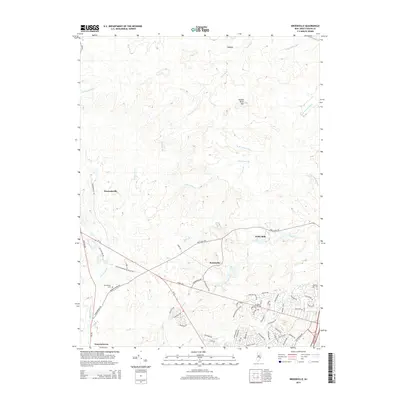
2014 Map of Brookville
USGS Topo · Published 2014About this map
Wells Mills and Brookville sit at the heart of this landscape, where the coastal plain of Ocean County is defined by a complex network of freshwater branches and creeks. The drainage patterns of the Oswego River and Oyster Cr dominate the southern half of the map, while Forked River Mtn rises as a notable landform to the north. These natural features are interspersed with small, historically established settlements like Howardsville and Warren Grove, which are connected by old transportation routes such as Old Cedar Bridge Barnegat Rd. Local genealogy and land use history are anchored by sites like Reevestown Cem and the Mill Pond, illustrating how early residents utilized the area's numerous waterways, including Cave Cabin Br and Long Br, for industry and survival in the Pine Barrens environment.
Find a feature on this map
73 named features on this map. Tap any name to fly to it.
Don’t see what you’re looking for? This feature index may not catch every label — zoom into the map to look around manually.
Map Details
Editions of this 2014 Brookville Map
This is the sole edition of this map. No revisions or reprints were ever made.
Other maps of this area

1884 · Whitings
USGS Topo · 1:62,500

1888 · Barnegat
USGS Topo · 1:62,500

1888 · Little Egg Harbor
USGS Topo · 1:62,500

1888 · Long Beach
USGS Topo · 1:62,500

1888 · Whitings
USGS Topo · 1:62,500

1893 · Little Egg Harbor
USGS Topo · 1:62,500

1893 · Long Beach
USGS Topo · 1:62,500

1893 · Barnegat
USGS Topo · 1:62,500

1898 · Barnegat
USGS Topo · 1:62,500

1919 · Long Beach
USGS Topo · 1:62,500
Featured Places
- Stafford Township, NJ
- Lacey Township, NJ
- Barnegat Township, NJ
- Ocean Township, NJ
- Howardsville, Barnegat Township