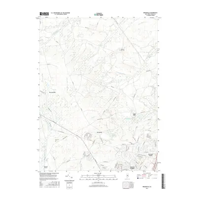
2016 Map of Brookville
USGS Topo · Published 2016About this map
Oyster Creek and its complex network of tributaries define this coastal plain landscape in Ocean County. The area is characterized by low-lying wetlands and traditional settlements like Brookville and Wells Mills, where the Wells Mills Reservoir and Mills Pond indicate a long history of water management. The southern portion of the sheet shows the expanding residential footprints of Ocean Acres and Barnegat Estates, contrasting with the more sparse, woodland-dominated interior. Local history is anchored by the Reevestown Cemetery near the junction of County Road 539 and Old Cedar Bridge Road. Numerous family-named branches, such as Cave Cabin Branch and Chamberlain Branch, feed the larger river systems like the Oswego River, reflecting the deeply etched hydrology of the Jersey Pinelands.
Find a feature on this map
86 named features on this map. Tap any name to fly to it.
Don’t see what you’re looking for? This feature index may not catch every label — zoom into the map to look around manually.
Map Details
Editions of this 2016 Brookville Map
This is the sole edition of this map. No revisions or reprints were ever made.
Other maps of this area

1884 · Whitings
USGS Topo · 1:62,500

1888 · Barnegat
USGS Topo · 1:62,500

1888 · Little Egg Harbor
USGS Topo · 1:62,500

1888 · Long Beach
USGS Topo · 1:62,500

1888 · Whitings
USGS Topo · 1:62,500

1893 · Little Egg Harbor
USGS Topo · 1:62,500

1893 · Long Beach
USGS Topo · 1:62,500

1893 · Barnegat
USGS Topo · 1:62,500

1898 · Barnegat
USGS Topo · 1:62,500

1919 · Long Beach
USGS Topo · 1:62,500
Featured Places
- Stafford Township, NJ
- Lacey Township, NJ
- Barnegat Township, NJ
- Ocean Township, NJ
- Howardsville, Barnegat Township