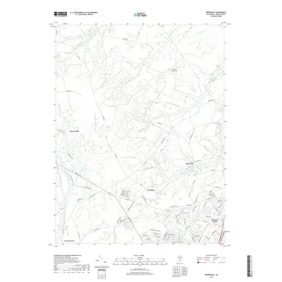
2019 Map of Brookville
USGS Topo · Published 2019About this map
The Oswego River and a dense network of branches like Chamberlain Br and Factory Br define this section of the New Jersey Pine Barrens. The landscape is characterized by its heavy concentration of narrow waterways and low-lying wetlands, supporting historically significant settlements such as Brookville and Howardsville. Further east, the Wells Mills Reservoir stands as a focal point of the local hydrography, while Forked River Mtn provides a rare point of elevation in the otherwise flat coastal plain. Toward the south and east, the transition from rural woods to residential development is evident in Barnegat Estates. Genealogists may find particular interest in the Reevestown Cem located near the intersection of Cedar Bridge Rd and Warren Grove Rd, offering a direct link to the area's early family history and isolated forest hamlets.
Find a feature on this map
88 named features on this map. Tap any name to fly to it.
Don’t see what you’re looking for? This feature index may not catch every label — zoom into the map to look around manually.
Map Details
Editions of this 2019 Brookville Map
This is the sole edition of this map. No revisions or reprints were ever made.
Other maps of this area

1884 · Whitings
USGS Topo · 1:62,500

1888 · Barnegat
USGS Topo · 1:62,500

1888 · Little Egg Harbor
USGS Topo · 1:62,500

1888 · Long Beach
USGS Topo · 1:62,500

1888 · Whitings
USGS Topo · 1:62,500

1893 · Little Egg Harbor
USGS Topo · 1:62,500

1893 · Long Beach
USGS Topo · 1:62,500

1893 · Barnegat
USGS Topo · 1:62,500

1898 · Barnegat
USGS Topo · 1:62,500

1919 · Long Beach
USGS Topo · 1:62,500
Featured Places
- Stafford Township, NJ
- Lacey Township, NJ
- Barnegat Township, NJ
- Ocean Township, NJ
- Howardsville, Barnegat Township