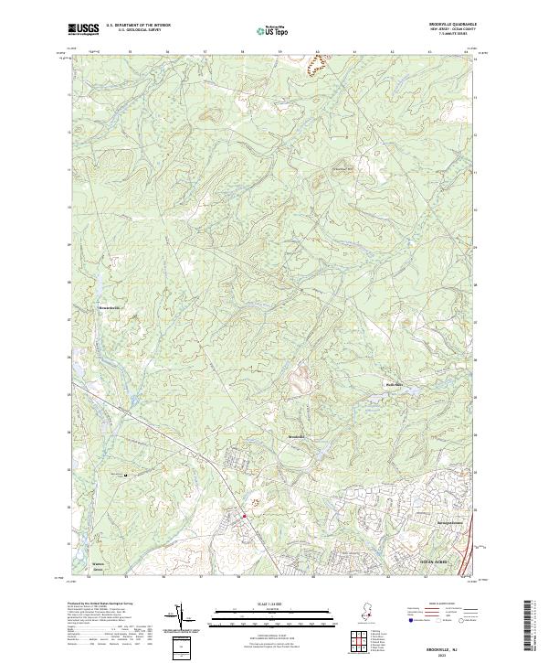
2023 Map of Brookville
USGS Topo · Published 2023About this map
Oyster Creek and the Oswego River define this stretch of the New Jersey Pine Barrens, where historic water-powered industry sites have evolved into modern conservation areas. In the center of the sheet, Brookville sits near the Mill Pond, reflecting a legacy of milling that once characterized these coastal plains. Further east, the Wells Mills Reservoir and the surrounding Wells Mills area show the transition from resource-extraction landscapes to recreational use.
Find a feature on this map
87 named features on this map. Tap any name to fly to it.
Don’t see what you’re looking for? This feature index may not catch every label — zoom into the map to look around manually.
Map Details
Editions of this 2023 Brookville Map
This is the sole edition of this map. No revisions or reprints were ever made.
Other maps of this area

1884 · Whitings
USGS Topo · 1:62,500

1888 · Barnegat
USGS Topo · 1:62,500

1888 · Little Egg Harbor
USGS Topo · 1:62,500

1888 · Long Beach
USGS Topo · 1:62,500

1888 · Whitings
USGS Topo · 1:62,500

1893 · Little Egg Harbor
USGS Topo · 1:62,500

1893 · Long Beach
USGS Topo · 1:62,500

1893 · Barnegat
USGS Topo · 1:62,500

1898 · Barnegat
USGS Topo · 1:62,500

1919 · Long Beach
USGS Topo · 1:62,500
Featured Places
- Stafford Township, NJ
- Lacey Township, NJ
- Barnegat Township, NJ
- Ocean Township, NJ
- Howardsville, Barnegat Township