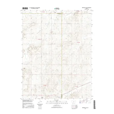
2015 Map of Brookville SW
USGS Topo · Published 2015About this map
Arcola and the geographic feature known as Buzzard Roost define the southern landscape of this Central Kansas region. The terrain transitions into the Smoky Hills, where a network of rural section-line roads like 29th Rd and Ave D navigate the rolling topography of the Ellsworth and Saline County line. In the northern reaches, Mulberry Creek winds past the Mulberry Cemetery, a focal point for genealogical research in this sparsely populated agricultural area. The presence of the Belcher Airport near the Lincoln County border suggests the continued importance of small-scale aviation for local land management and travel. Waterways such as Table Rock Creek and West Spring Creek provide drainage through the hills, illustrating the natural hydrological patterns that have shaped land use since early settlement.
Find a feature on this map
36 named features on this map. Tap any name to fly to it.
Don’t see what you’re looking for? This feature index may not catch every label — zoom into the map to look around manually.
Map Details
Editions of this 2015 Brookville SW Map
This is the sole edition of this map. No revisions or reprints were ever made.
Other maps of this area

1892 · Salina
USGS Topo · 1:125,000

1894 · Ellsworth
USGS Topo · 1:125,000

1942 · Salina
USGS Topo · 1:125,000

1955 · Brookville
USGS Topo · 1:24,000

1955 · Culver
USGS Topo · 1:24,000

1955 · Falun
USGS Topo · 1:24,000

1955 · Great Bend
USGS Topo · 1:250,000

1955 · Hutchinson
USGS Topo · 1:250,000

1957 · Great Bend
USGS Topo · 1:250,000

1957 · Brookville SW
USGS Topo · 1:24,000