
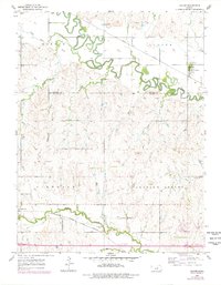
1955 Map of Culver
USGS Topo · Published 1956About this map
The Saline River meanders sharply across the northern sections of this mid-century survey, defining the landscape of Morton and Culver townships. The town of Culver is situated along the Union Pacific line, while to the south, the settlement of Glendale lies near the Atchison Topeka and Santa Fe railroad and the banks of Mulberry Creek. This area of the Ottawa and Saline County border shows a typical Kansas agricultural and transport network, where the railroads and river valleys dictated the placement of rural infrastructure.
Find a feature on this map
19 named features on this map. Tap any name to fly to it.
Don’t see what you’re looking for? This feature index may not catch every label — zoom into the map to look around manually.
Map Details
Editions of this 1955 Culver Map
2 editions found
Other maps of this area

1892 · Salina
USGS Topo · 1:125,000

1892 · Minneapolis
USGS Topo · 1:125,000

1942 · Salina
USGS Topo · 1:125,000

1955 · Salina SW
USGS Topo · 1:24,000

1955 · Trenton
USGS Topo · 1:24,000

1955 · Brookville
USGS Topo · 1:24,000

1955 · Manhattan
USGS Topo · 1:250,000

1955 · Hutchinson
USGS Topo · 1:250,000

1956 · Manhattan
USGS Topo · 1:250,000

1957 · Manhattan
USGS Topo · 1:250,000