
1955 Map of Trenton
USGS Topo · Published 1956About this map
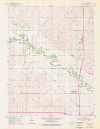
The Saline River winds in tight, serpentine oxbows across this Kansas landscape, defining the topography of both Ottawa and Saline Counties. In the mid-1950s, the Union Pacific railroad corridor anchored a series of small rural sidings and settlements including Marydel, Shipton, and Trenton. This survey captures the agrarian layout of Pleasant Valley and neighboring townships, where section lines dictate the road network and property boundaries. The density of community infrastructure—from Lockard and Shiloh schools to local burial grounds like Walnut Hill Cem and Crown Point Cem—reveals a well-established rural population before the consolidation of mid-century farming. To the east, the terrain rises into more dissected hills near Wary Lake, contrasting with the broad alluvial flats and occasional gravel pits found along the river’s path.
Find a feature on this map
19 named features on this map. Tap any name to fly to it.
Don’t see what you’re looking for? This feature index may not catch every label — zoom into the map to look around manually.
Map Details
Editions of this 1955 Trenton Map
2 editions found
Other maps of this area

1892 · Salina
USGS Topo · 1:125,000

1892 · Minneapolis
USGS Topo · 1:125,000

1942 · Salina
USGS Topo · 1:125,000

1955 · Salina
USGS Topo · 1:24,000

1955 · Salina SW
USGS Topo · 1:24,000

1955 · Brookville
USGS Topo · 1:24,000

1955 · Culver
USGS Topo · 1:24,000

1955 · New Cambria
USGS Topo · 1:24,000

1955 · Manhattan
USGS Topo · 1:250,000

1955 · Hutchinson
USGS Topo · 1:250,000