
1955 Map of Salina SW
USGS Topo · Published 1956About this map
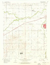
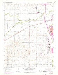
The southwest outskirts of Salina are defined by a complex intersection of mid-century infrastructure and rural Kansas life. The northern landscape is shaped by the winding courses of Mulberry Creek and Elm Creek, while the southern portion is dominated by the sprawling Smoky Hill Air Force Base. Transportation is central to this area's development, as seen in the heavy rail presence including the Union Pacific, Atchison Topeka and Santa Fe, and Missouri Pacific lines.
Find a feature on this map
29 named features on this map. Tap any name to fly to it.
Don’t see what you’re looking for? This feature index may not catch every label — zoom into the map to look around manually.
Map Details
Editions of this 1955 Salina SW Map
3 editions found
Other maps of this area

1892 · Salina
USGS Topo · 1:125,000

1942 · Salina
USGS Topo · 1:125,000

1955 · Salina
USGS Topo · 1:24,000

1955 · Assaria
USGS Topo · 1:24,000

1955 · Trenton
USGS Topo · 1:24,000

1955 · Smolan
USGS Topo · 1:24,000

1955 · Brookville
USGS Topo · 1:24,000

1955 · Culver
USGS Topo · 1:24,000

1955 · New Cambria
USGS Topo · 1:24,000

1955 · Falun
USGS Topo · 1:24,000