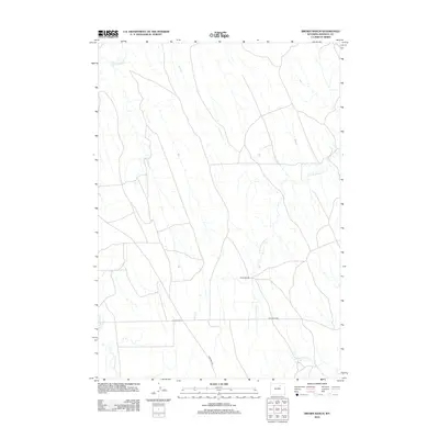
2012 Map of Brown Ranch
USGS Topo · Published 2012About this map
The historic Bozeman Trl cuts across the western half of this landscape, marking a legacy of travel and westward migration through the heart of the Powder River Basin. This modern 2012 survey illustrates the enduring ranching character of Johnson County, anchored by the namesake Brown Ranch and the road junction at Four Corners. The terrain is defined by a dense network of seasonal drainages, where the Crazy Woman Cr flows across the northern edge and multiple branches of the N Fork Fourmile Cr and S Fork Fourmile Cr weave through the sagebrush-covered plains. Local road infrastructure, including Hoe Ranch Rd, follows these natural contours, serving the isolated agricultural holdings that have persisted since the era of the open range. The map provides a detailed view of the modern rural landscape while preserving the nomenclature of its frontier past.
Find a feature on this map
8 named features on this map. Tap any name to fly to it.
Don’t see what you’re looking for? This feature index may not catch every label — zoom into the map to look around manually.
Map Details
Editions of this 2012 Brown Ranch Map
This is the sole edition of this map. No revisions or reprints were ever made.
Other maps of this area

1900 · Fort McKinney
USGS Topo · 1:125,000

1903 · Fort McKinney
USGS Topo · 1:125,000

1955 · Sheridan
USGS Topo · 1:250,000

1955 · Arminto
USGS Topo · 1:250,000

1958 · Sheridan
USGS Topo · 1:250,000

1958 · Arminto
USGS Topo · 1:250,000

1961 · Antelope Draw
USGS Topo · 1:24,000

1961 · Provence Ranch
USGS Topo · 1:24,000

1961 · Elaine Draw
USGS Topo · 1:24,000

1962 · Sheridan
USGS Topo · 1:250,000