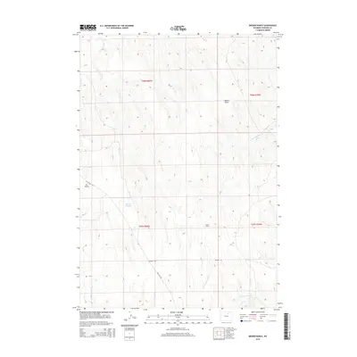
2015 Map of Brown Ranch
USGS Topo · Published 2015About this map
Brown Ranch serves as a central landmark in this high-plains landscape of Johnson County, where the drainage patterns of the Powder River Basin define the local geography. The area is characterized by a series of intermittent watercourses and draws, including Crazy Woman Cr in the northwest and the winding paths of N Fork Fourmile Cr and S Fork Fourmile Cr to the south. This ranching country relies on water management features like the Murphy Reservoir to sustain operations in an arid environment. Transportation through the townships is limited to established routes such as Nine Mile Rd and Irigaray Rd, which cut across the geometric grid of the Public Land Survey System. The terrain is further detailed by named features like Walker Draw and Dry Gulch, illustrating the erosional character of the Wyoming landscape.
Find a feature on this map
14 named features on this map. Tap any name to fly to it.
Don’t see what you’re looking for? This feature index may not catch every label — zoom into the map to look around manually.
Map Details
Editions of this 2015 Brown Ranch Map
This is the sole edition of this map. No revisions or reprints were ever made.
Other maps of this area

1900 · Fort McKinney
USGS Topo · 1:125,000

1903 · Fort McKinney
USGS Topo · 1:125,000

1955 · Sheridan
USGS Topo · 1:250,000

1955 · Arminto
USGS Topo · 1:250,000

1958 · Sheridan
USGS Topo · 1:250,000

1958 · Arminto
USGS Topo · 1:250,000

1961 · Antelope Draw
USGS Topo · 1:24,000

1961 · Provence Ranch
USGS Topo · 1:24,000

1961 · Elaine Draw
USGS Topo · 1:24,000

1962 · Sheridan
USGS Topo · 1:250,000