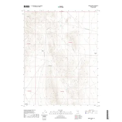
2018 Map of Brown Summit
USGS Topo · Published 2018About this map
The Pancake Range dominates this portion of Nye County, where the high desert terrain defines a landscape of significant elevation changes and isolated water sources. Named summits like Moody Mtn and the namesake Brown Summit provide orientation points in a territory where the environment dictates human movement and land use. The presence of Young Florio Spring and McClure Spring highlights the critical importance of reliable water in the Great Basin, likely serving as essential stops for travelers and livestock alike.
Find a feature on this map
13 named features on this map. Tap any name to fly to it.
Don’t see what you’re looking for? This feature index may not catch every label — zoom into the map to look around manually.
Map Details
Editions of this 2018 Brown Summit Map
This is the sole edition of this map. No revisions or reprints were ever made.
Other maps of this area

1951 · Green Springs
USGS Topo · 1:62,500

1956 · Lund
USGS Topo · 1:250,000

1956 · Ely
USGS Topo · 1:250,000

1959 · Ely
USGS Topo · 1:250,000

1960 · Lund
USGS Topo · 1:250,000

1963 · Ely
USGS Topo · 1:250,000

1964 · Duckwater
USGS Topo · 1:62,500

1964 · Moody Peak
USGS Topo · 1:62,500

1968 · Brown Summit
USGS Topo · 1:24,000
1968 · Brown Summit NW
USGS Topo · 1:24,000