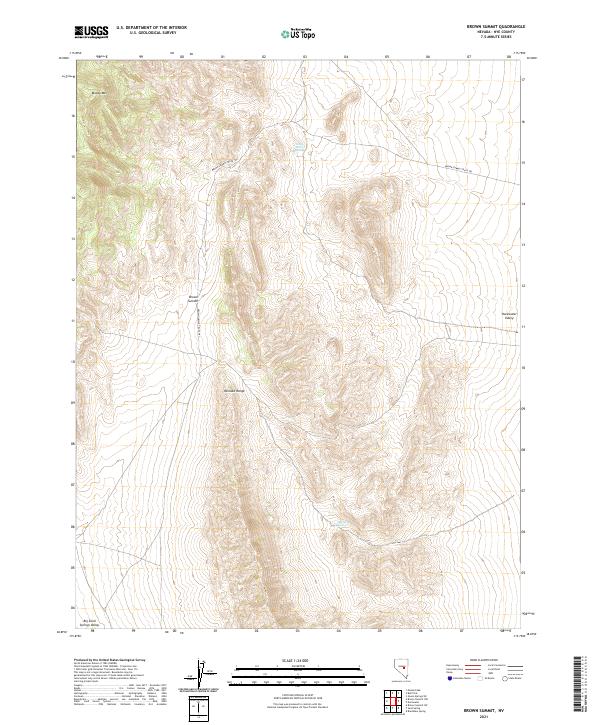
2021 Map of Brown Summit
USGS Topo · Published 2021About this map
The Pancake Range dominates this portion of Nye County, where the high-altitude terrain creates a watershed that feeds remote desert water sources. Small but vital water points like Young Florio Spring and McClure Spring are scattered across the slopes, marking essential stops for range travel in an arid environment. The map highlights the primitive transportation network of the modern era, centered on the Brown Summit Truck Trl which winds through the central elevations near Brown Summit.
Find a feature on this map
13 named features on this map. Tap any name to fly to it.
Don’t see what you’re looking for? This feature index may not catch every label — zoom into the map to look around manually.
Map Details
Editions of this 2021 Brown Summit Map
This is the sole edition of this map. No revisions or reprints were ever made.
Other maps of this area

1951 · Green Springs
USGS Topo · 1:62,500

1956 · Lund
USGS Topo · 1:250,000

1956 · Ely
USGS Topo · 1:250,000

1959 · Ely
USGS Topo · 1:250,000

1960 · Lund
USGS Topo · 1:250,000

1963 · Ely
USGS Topo · 1:250,000

1964 · Duckwater
USGS Topo · 1:62,500

1964 · Moody Peak
USGS Topo · 1:62,500

1968 · Brown Summit
USGS Topo · 1:24,000
1968 · Brown Summit NW
USGS Topo · 1:24,000