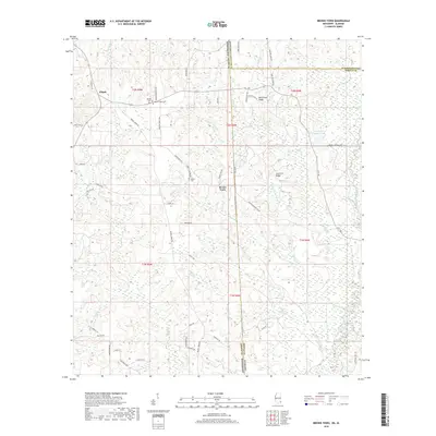
2018 Map of Brown Town
USGS Topo · Published 2018About this map
Brown Town sits at the heart of this landscape, positioned along the boundary between Greene County, Mississippi, and Washington County, Alabama. The area is defined by a dense network of tributaries, including Nobodies Cr and Pond Cr, which flow through the undulating terrain marked by Mash Fork Ridge and Lott Fork Ridge. To the west, the settlement of Pisgah is anchored by the Mount Pisgah Cem, while the Maples Cem is located further east near the center of the sheet. The southern reaches of the map are characterized by the winding path of the Escatawpa River and Alligator Br. This survey documents a quiet rural corridor where small family-named cemeteries and a complex system of creek branches suggest a history of decentralized settlement along the state line.
Find a feature on this map
62 named features on this map. Tap any name to fly to it.
Don’t see what you’re looking for? This feature index may not catch every label — zoom into the map to look around manually.
Map Details
Editions of this 2018 Brown Town Map
This is the sole edition of this map. No revisions or reprints were ever made.
Other maps of this area

1941 · Lucedale
USGS Topo · 1:62,500

1942 · Deer Park
USGS Topo · 1:62,500

1942 · Wilmer
USGS Topo · 1:62,500

1943 · Lucedale
USGS Topo · 1:62,500

1943 · Deer Park
USGS Topo · 1:62,500

1944 · Wilmer
USGS Topo · 1:62,500

1953 · Hattiesburg
USGS Topo · 1:250,000

1953 · Mobile
USGS Topo · 1:250,000

1957 · Mobile
USGS Topo · 1:250,000

1958 · Hattiesburg
USGS Topo · 1:250,000