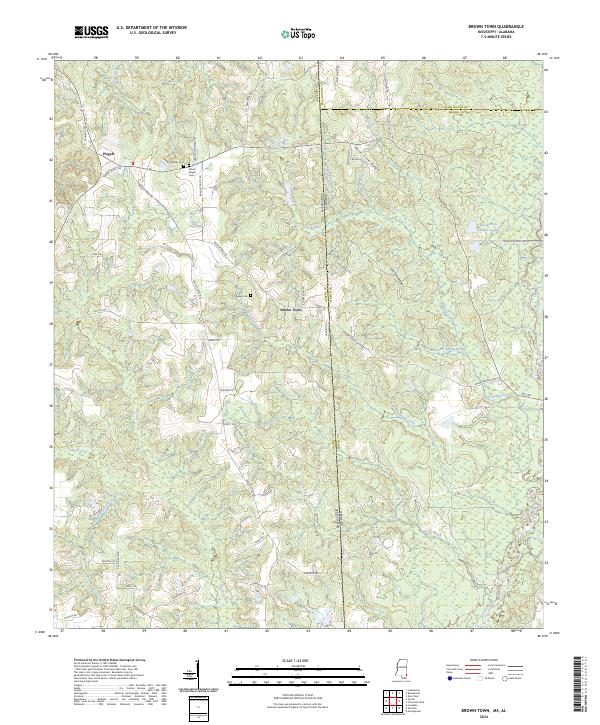
2024 Map of Brown Town
USGS Topo · Published 2024About this map
Brown Town and the neighboring community of Pisgah sit at the intersection of several county lines where Mississippi meets Alabama. This modern 2024 landscape is defined by the winding course of the Escatawpa River in the southeast and the network of creeks that drain the local ridges, such as Islelet Creek and Pond Creek. The topography is marked by significant elevation changes along Mash Fork Ridge and Lott Fork Ridge, which helped shape the early road patterns of the region. Family names are preserved throughout the area in landmarks like Maples Cem and the Mount Pisgah Cem. Local history is further reflected in the naming of roads like Aaron Dueitt Rd and Herman Denmark Rd, while more functional historical markers like Cattle Gap remain visible on the modern survey.
Find a feature on this map
63 named features on this map. Tap any name to fly to it.
Don’t see what you’re looking for? This feature index may not catch every label — zoom into the map to look around manually.
Map Details
Editions of this 2024 Brown Town Map
This is the sole edition of this map. No revisions or reprints were ever made.
Other maps of this area

1941 · Lucedale
USGS Topo · 1:62,500

1942 · Deer Park
USGS Topo · 1:62,500

1942 · Wilmer
USGS Topo · 1:62,500

1943 · Lucedale
USGS Topo · 1:62,500

1943 · Deer Park
USGS Topo · 1:62,500

1944 · Wilmer
USGS Topo · 1:62,500

1953 · Hattiesburg
USGS Topo · 1:250,000

1953 · Mobile
USGS Topo · 1:250,000

1957 · Mobile
USGS Topo · 1:250,000

1958 · Hattiesburg
USGS Topo · 1:250,000