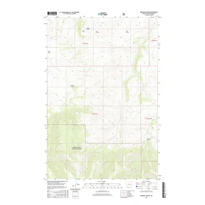
2017 Map of Browns Canyon
USGS Topo · Published 2017About this map
Lewis & Clark National Forest dominates the southern half of this landscape, where the terrain transitions from high plateaus into complex drainages. The northern sections are defined by a series of named coulees and gulches that channel water toward the northeast, including Hopkins Coulee, Alice Coulee, and Ellis Coulee. These features illustrate the erosion patterns typical of the Judith Basin area, with Pine Knob serving as a localized high point overlooking the network of dry and seasonal washes.
Find a feature on this map
15 named features on this map. Tap any name to fly to it.
Don’t see what you’re looking for? This feature index may not catch every label — zoom into the map to look around manually.
Map Details
Editions of this 2017 Browns Canyon Map
This is the sole edition of this map. No revisions or reprints were ever made.
Other maps of this area

1886 · Little Belt Mts.
USGS Topo · 1:250,000

1894 · Little Belt Mts.
USGS Topo · 1:250,000

1897 · Little Belt Mts.
USGS Topo · 1:250,000

1898 · Little Belt Mts.
USGS Topo · 1:250,000

1902 · Little Belt Mts.
USGS Topo · 1:250,000

1948 · White Sulphur Springs
USGS Topo · 1:250,000

1958 · White Sulphur Springs
USGS Topo · 1:250,000

1961 · White Sulphur Springs
USGS Topo · 1:250,000

1965 · White Sulphur Springs
USGS Topo · 1:250,000
1970 · Woodhurst Mountain
USGS Topo · 1:24,000