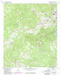
1972 Map of Browns Crossing
USGS Topo · Published 1986About this map
Baldwin State Forest dominates the central landscape of this Baldwin County region, where the terrain is heavily carved by the drainages of Fishing Creek and Little Fishing Creek. The map documents a diverse mix of institutional and rural land use, ranging from the State Training School for Boys and Baldwin Vocational Sch near the western edge of Milledgeville to scattered country churches like Antioch Ch and Pardue Tabernacle. Two major rail lines, the Central of Georgia and the Seaboard Coast Line, bisect the area, connecting small communities such as Blandy and Browns Crossing. The 1980s updates also reflect mid-century leisure and infrastructure, including a Drive-in Theater, a Golf Course, and multiple industrial sites like the Filtration Plant and various claypits, highlighting the area's economic transition from traditional agriculture to state-managed forests and industrial services.
Find a feature on this map
39 named features on this map. Tap any name to fly to it.
Don’t see what you’re looking for? This feature index may not catch every label — zoom into the map to look around manually.
Map Details
Editions of this 1972 Browns Crossing Map
2 editions found
Other maps of this area

1912 · Milledgeville
USGS Topo · 1:62,500

1916 · Irwinton
USGS Topo · 1:62,500

1920 · Irwinton
USGS Topo · 1:62,500

1953 · Athens
USGS Topo · 1:250,000

1956 · Gordon
USGS Topo · 1:62,500

1957 · Macon
USGS Topo · 1:250,000

1958 · Macon
USGS Topo · 1:250,000

1958 · Athens
USGS Topo · 1:250,000

1959 · Athens
USGS Topo · 1:250,000

1963 · Athens
USGS Topo · 1:250,000