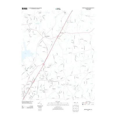
2013 Map of Browns Summit
USGS Topo · Published 2013About this map
Browns Summit anchors this region of northern Guilford County, where suburban expansion meets the established rural drainages of the Reedy Fork and Buffalo Creek. The landscape is defined by its water management, featuring several significant reservoirs such as Lake Townsend, Lake Herman, and Lakewood Lake. Smaller historical markers like Hardys Mill Pond hint at earlier land use before the modern residential developments seen around Lakewood and Monticello. To the north, the settlement of Benaja sits near the headwaters of Benaja Creek, while the southern reaches are dominated by the winding paths of North Buffalo Creek and Blackwood Creek. This 2013 survey illustrates the shift from isolated hamlets like Rudd toward a more interconnected landscape of named drives and suburban subdivisions, while preserving the namesake summit and its surrounding topography.
Find a feature on this map
194 named features on this map. Tap any name to fly to it.
Don’t see what you’re looking for? This feature index may not catch every label — zoom into the map to look around manually.
Map Details
Editions of this 2013 Browns Summit Map
This is the sole edition of this map. No revisions or reprints were ever made.
Other maps of this area

1951 · Lake Brandt
USGS Topo · 1:24,000

1951 · Browns Summit
USGS Topo · 1:24,000

1951 · Greensboro
USGS Topo · 1:24,000

1952 · Mc Leansville
USGS Topo · 1:24,000

1953 · Greensboro
USGS Topo · 1:250,000

1954 · Greensboro
USGS Topo · 1:250,000

1962 · Greensboro
USGS Topo · 1:250,000

1966 · Greensboro
USGS Topo · 1:250,000

1970 · Gibsonville
USGS Topo · 1:24,000

1970 · Ossipee
USGS Topo · 1:24,000