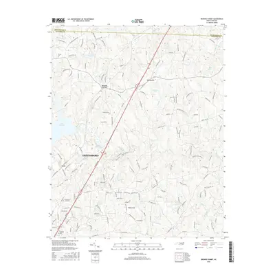
2016 Map of Browns Summit
USGS Topo · Published 2016About this map
Browns Summit and Monticello anchor the northern reaches of this Guilford County landscape, where rural communities meet the expanding northern outskirts of Greensboro. The terrain is defined by the headwaters of the Reedy Fork and Buffalo Cr, creating a series of impoundments including Lake Townsend, Hardys Mill Pond, and Lake Herman. These water bodies, alongside smaller features like Brooks Lake and Smothers Lake, illustrate the region's managed water network. Genealogical interest is centered on family and community landmarks such as Phibbs Cem and Green Hall Cem, as well as the larger Lakeview Memorial Park further south. The map documents the residential development patterns along Mcleansville Rd and Old Reidsville Rd, showing the transition from crossroads settlements like Rudd and Lakewood into a more integrated suburban corridor north of the city center.
Find a feature on this map
146 named features on this map. Tap any name to fly to it.
Don’t see what you’re looking for? This feature index may not catch every label — zoom into the map to look around manually.
Map Details
Editions of this 2016 Browns Summit Map
This is the sole edition of this map. No revisions or reprints were ever made.
Other maps of this area

1951 · Lake Brandt
USGS Topo · 1:24,000

1951 · Browns Summit
USGS Topo · 1:24,000

1951 · Greensboro
USGS Topo · 1:24,000

1952 · Mc Leansville
USGS Topo · 1:24,000

1953 · Greensboro
USGS Topo · 1:250,000

1954 · Greensboro
USGS Topo · 1:250,000

1962 · Greensboro
USGS Topo · 1:250,000

1966 · Greensboro
USGS Topo · 1:250,000

1970 · Gibsonville
USGS Topo · 1:24,000

1970 · Ossipee
USGS Topo · 1:24,000