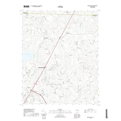
2019 Map of Browns Summit
USGS Topo · Published 2019About this map
Browns Summit and the northern outskirts of Greensboro define this landscape along the Rockingham and Guilford County line. The area is characterized by the intricate drainage systems of Reedy Fork and its tributaries, which feed into significant water bodies such as Lake Townsend and Lake Herman. Small residential nodes like Monticello and Benaja are interspersed among a network of rural roads, including Old Reidsville Rd and Fairgrove Church Rd, reflecting the region's transition from traditional agricultural use to suburban expansion.
Find a feature on this map
154 named features on this map. Tap any name to fly to it.
Don’t see what you’re looking for? This feature index may not catch every label — zoom into the map to look around manually.
Map Details
Editions of this 2019 Browns Summit Map
This is the sole edition of this map. No revisions or reprints were ever made.
Other maps of this area

1951 · Lake Brandt
USGS Topo · 1:24,000

1951 · Browns Summit
USGS Topo · 1:24,000

1951 · Greensboro
USGS Topo · 1:24,000

1952 · Mc Leansville
USGS Topo · 1:24,000

1953 · Greensboro
USGS Topo · 1:250,000

1954 · Greensboro
USGS Topo · 1:250,000

1962 · Greensboro
USGS Topo · 1:250,000

1966 · Greensboro
USGS Topo · 1:250,000

1970 · Gibsonville
USGS Topo · 1:24,000

1970 · Ossipee
USGS Topo · 1:24,000