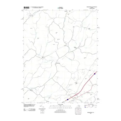
2010 Map of Brownsburg
USGS Topo · Published 2010About this map
Brownsburg and the surrounding agricultural landscape of Augusta County are defined by a network of creeks and prominent ridges in this 2010 survey. The topography is shaped by heights like Big Hill, Pisgah Hill, and Roundtop Hill, with the valleys between them supporting scattered settlements and historic water-powered sites such as McClung Mill and Wades Mill. The importance of local heritage is visible in the distribution of community spaces like New Providence Cemetery and Fairfield Cemetery.
Find a feature on this map
64 named features on this map. Tap any name to fly to it.
Don’t see what you’re looking for? This feature index may not catch every label — zoom into the map to look around manually.
Map Details
Editions of this 2010 Brownsburg Map
This is the sole edition of this map. No revisions or reprints were ever made.
Other maps of this area

1894 · Staunton
USGS Topo · 1:125,000

1894 · Lexington
USGS Topo · 1:125,000

1932 · Lexington
USGS Topo · 1:48,000

1936 · Vesuvius
USGS Topo · 1:48,000

1937 · Lexington
USGS Topo · 1:62,500

1941 · Vesuvius
USGS Topo · 1:62,500

1943 · Craigsville
USGS Topo · 1:62,500

1944 · Staunton
USGS Topo · 1:62,500

1945 · Craigsville
USGS Topo · 1:62,500

1947 · Staunton
USGS Topo · 1:62,500