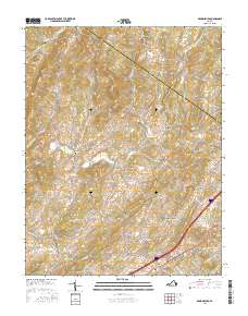
2016 Map of Brownsburg
USGS Topo · Published 2016About this map
Brownsburg and Fairfield anchor this portion of the Shenandoah Valley, where the landscape is defined by the rolling divides of Augusta Co and Rockbridge Co. The map documents a rural economy historically tied to water power, evidenced by the locations of Wades Mill along Moffatts Cr and Mcclung Mill on Hays Cr. These milling sites, along with smaller settlements like Bustleburg, Zack, and Jonestown, illustrate the 19th-century pattern of development along the creeks that feed into Walker Cr and Stony Run.
Find a feature on this map
92 named features on this map. Tap any name to fly to it.
Don’t see what you’re looking for? This feature index may not catch every label — zoom into the map to look around manually.
Map Details
Editions of this 2016 Brownsburg Map
This is the sole edition of this map. No revisions or reprints were ever made.
Other maps of this area

1894 · Staunton
USGS Topo · 1:125,000

1894 · Lexington
USGS Topo · 1:125,000

1932 · Lexington
USGS Topo · 1:48,000

1936 · Vesuvius
USGS Topo · 1:48,000

1937 · Lexington
USGS Topo · 1:62,500

1941 · Vesuvius
USGS Topo · 1:62,500

1943 · Craigsville
USGS Topo · 1:62,500

1944 · Staunton
USGS Topo · 1:62,500

1945 · Craigsville
USGS Topo · 1:62,500

1947 · Staunton
USGS Topo · 1:62,500