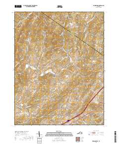
2019 Map of Brownsburg
USGS Topo · Published 2019About this map
Brownsburg and the surrounding Shenandoah Valley landscape are defined by a complex network of ridges and watercourses along the Augusta and Rockbridge county line. The map highlights a localized agrarian and early industrial economy, evidenced by historic milling sites like McClung Mill and Wades Mill situated along Hays Cr and Moffatts Cr. These settlements are connected by a dense web of named roads and turnpikes, including the Brownsburg Tpke, reflecting the area's long-standing role as a corridor for travel and trade.
Find a feature on this map
101 named features on this map. Tap any name to fly to it.
Don’t see what you’re looking for? This feature index may not catch every label — zoom into the map to look around manually.
Map Details
Editions of this 2019 Brownsburg Map
This is the sole edition of this map. No revisions or reprints were ever made.
Other maps of this area

1894 · Staunton
USGS Topo · 1:125,000

1894 · Lexington
USGS Topo · 1:125,000

1932 · Lexington
USGS Topo · 1:48,000

1936 · Vesuvius
USGS Topo · 1:48,000

1937 · Lexington
USGS Topo · 1:62,500

1941 · Vesuvius
USGS Topo · 1:62,500

1943 · Craigsville
USGS Topo · 1:62,500

1944 · Staunton
USGS Topo · 1:62,500

1945 · Craigsville
USGS Topo · 1:62,500

1947 · Staunton
USGS Topo · 1:62,500