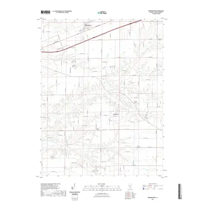
2021 Map of Brownstown
USGS Topo · Published 2021About this map
Brownstown serves as a central hub for this portion of Fayette County, situated along the corridor of E Cumberland Rd. The landscape is defined by a dense network of family and community burial sites, which suggest a long-established rural population. Notable locations for genealogical interest include the Old Loogootee Cem and Arm Prairie Cem, along with several family-named plots like Winslow Pilcher-Cem and Cheshier Cem. South of the main settlement, the community of Confidence sits near the winding paths of Hickory Cr and Little Hickory Cr. This network of waterways, which also includes Sandy Run and Gatch Lake, dictates the local geography and the placement of the county road grid. The presence of the German Reformed Cem further highlights the early cultural and religious foundations of these small agricultural townships.
Find a feature on this map
86 named features on this map. Tap any name to fly to it.
Don’t see what you’re looking for? This feature index may not catch every label — zoom into the map to look around manually.
Map Details
Editions of this 2021 Brownstown Map
This is the sole edition of this map. No revisions or reprints were ever made.
Other maps of this area

1941 · St. Elmo
USGS Topo · 1:62,500

1944 · Ramsey
USGS Topo · 1:62,500

1945 · St. Elmo
USGS Topo · 1:62,500

1945 · Kinmundy
USGS Topo · 1:62,500

1945 · Vandalia
USGS Topo · 1:62,500

1946 · Ramsey
USGS Topo · 1:62,500

1947 · Vandalia
USGS Topo · 1:62,500

1947 · Kinmundy
USGS Topo · 1:62,500

1958 · Decatur
USGS Topo · 1:250,000

1958 · Belleville
USGS Topo · 1:250,000