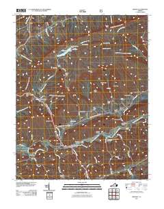
2011 Map of Brumley
USGS Topo · Published 2011About this map
Brumley Mountain and the high ridges of the Clinch Mountain range dominate this landscape in southwestern Virginia. Near the center, Hidden Valley Lake sits tucked into a high valley, held by the Hidden Valley Lake Dam and surrounded by a network of steep hollows like Shovel Hollow and Stagger Hollow. To the south, the North Fork Holston River cuts through the valley floor, crossed by the Colonel Thomas McCulloch Memorial Bridge near the settlement of Holston. This 2011 survey documents a mix of high-elevation wilderness and valley floor agriculture, where old family names persist in the landscape through locations such as Phelps Cemetery and Mongle Spring. The terrain is characterized by long, parallel ridges like Bryson Ridge and deep coves such as Bear Cove, illustrating the classic ridge-and-valley topography of the region.
Find a feature on this map
69 named features on this map. Tap any name to fly to it.
Don’t see what you’re looking for? This feature index may not catch every label — zoom into the map to look around manually.
Map Details
Editions of this 2011 Brumley Map
This is the sole edition of this map. No revisions or reprints were ever made.
Other maps of this area

1891 · Abingdon
USGS Topo · 1:125,000

1894 · Abingdon
USGS Topo · 1:125,000

1897 · Bristol
USGS Topo · 1:125,000

1902 · Bristol
USGS Topo · 1:125,000

1909 · Abingdon
USGS Topo · 1:96,000

1911 · Abingdon
USGS Topo · 1:125,000

1918 · Carterton
USGS Topo · 1:62,500
1934 · Lebanon
USGS Topo · 1:24,000

1934 · Wallace
USGS Topo · 1:24,000

1934 · Brumley
USGS Topo · 1:24,000