
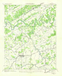
1934 Map of Brumley
USGS Topo · Published 1934About this map
North Fork Holston River carves through the southern landscape of this 1934 survey, a period when the Tennessee Valley Authority was actively mapping the region's complex topography. The map illustrates a series of parallel ridges and valleys, including Clinch Mountain, Poor Valley, and Rich Valley. This corrugated terrain dictated the settlement patterns of the era, with small communities and essential institutions tucked into the lowlands.
Find a feature on this map
62 named features on this map. Tap any name to fly to it.
Don’t see what you’re looking for? This feature index may not catch every label — zoom into the map to look around manually.
Map Details
Editions of this 1934 Brumley Map
This is the sole edition of this map. No revisions or reprints were ever made.
Other maps of this area

1891 · Abingdon
USGS Topo · 1:125,000

1894 · Abingdon
USGS Topo · 1:125,000

1897 · Bristol
USGS Topo · 1:125,000

1902 · Bristol
USGS Topo · 1:125,000

1909 · Abingdon
USGS Topo · 1:96,000

1911 · Abingdon
USGS Topo · 1:125,000

1918 · Carterton
USGS Topo · 1:62,500
1934 · Lebanon
USGS Topo · 1:24,000

1934 · Wallace
USGS Topo · 1:24,000

1934 · Hansonville
USGS Topo · 1:24,000