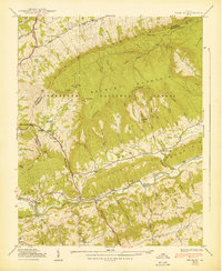
1939 Map of Brumley
USGS Topo · Published 1939About this map
The North Fork Holston River carves through the landscape of Washington County and Russell County, highlighting a region defined by dramatic ridgelines and agricultural valleys in the late 1930s. Clinch Mountain and Brumley Rim dominate the northern half of the survey, sheltering small mountain communities and hollows. The presence of the State Prison Camp near Willis indicates the social infrastructure of the era, while the network of schools and houses of worship like Hayes Sch and Green Valley Ch reveal the established rural social fabric.
Find a feature on this map
101 named features on this map. Tap any name to fly to it.
Don’t see what you’re looking for? This feature index may not catch every label — zoom into the map to look around manually.
Map Details
Editions of this 1939 Brumley Map
2 editions found
Other maps of this area

1891 · Abingdon
USGS Topo · 1:125,000

1894 · Abingdon
USGS Topo · 1:125,000

1897 · Bristol
USGS Topo · 1:125,000

1902 · Bristol
USGS Topo · 1:125,000

1909 · Abingdon
USGS Topo · 1:96,000

1911 · Abingdon
USGS Topo · 1:125,000

1918 · Carterton
USGS Topo · 1:62,500
1934 · Lebanon
USGS Topo · 1:24,000

1934 · Wallace
USGS Topo · 1:24,000

1934 · Brumley
USGS Topo · 1:24,000