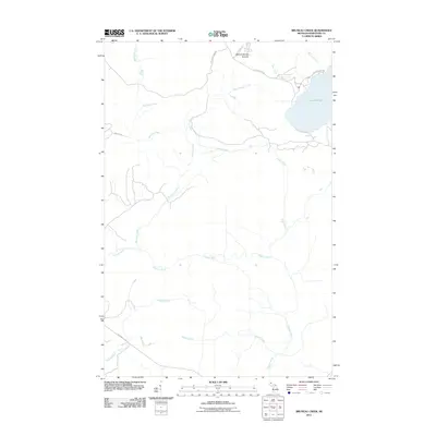
2011 Map of Bruneau Creek
USGS Topo · Published 2011About this map
Mount Horace Greeley stands as a prominent landmark in this northern reach of the Keweenaw Peninsula, anchoring a landscape defined by an intricate network of waterways flowing toward Lake Superior. The northeastern portion of the sheet is dominated by the significant waters of Lake Gratiot, which is fed by Elster Creek and drained by the Little Gratiot River. The hydrology of the area is exceptionally dense, featuring numerous parallel and intersecting drainages such as Snake Creek, Bruneau Creek, and the Tobacco River. Human impact is primarily reflected in the road network serving this timbered terrain, with routes like Gratiot Lake Rd and Mohawk Gay Rd providing access to the interior. The map illustrates a transitional wilderness where the high ground of the ridge gives way to the low-lying basins of the Traverse River and Black Creek.
Find a feature on this map
17 named features on this map. Tap any name to fly to it.
Don’t see what you’re looking for? This feature index may not catch every label — zoom into the map to look around manually.
Map Details
Editions of this 2011 Bruneau Creek Map
This is the sole edition of this map. No revisions or reprints were ever made.
Other maps of this area

1938 · Bruneau Creek
USGS Topo · 1:31,680

1938 · Gay
USGS Topo · 1:31,680

1938 · Delaware
USGS Topo · 1:31,680

1939 · Deer Lake
USGS Topo · 1:31,680

1939 · Delaware
USGS Topo · 1:31,680

1940 · Deer Lake
USGS Topo · 1:31,680

1940 · Central
USGS Topo · 1:31,680

1941 · Mohawk
USGS Topo · 1:31,680

1946 · Phoenix
USGS Topo · 1:24,000

1946 · Bruneau Creek
USGS Topo · 1:24,000
Featured Places
- Eagle Harbor Township, MI
- Gratiot Lake Beach, MI
- Sherman Township, MI
- Houghton Township, MI
- Keweenaw County, MI