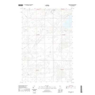
2019 Map of Bruneau Creek
USGS Topo · Published 2019About this map
Mt Horace Greeley stands as the highest point in this section of the Keweenaw Peninsula, overlooking a landscape defined by the expansive Lake Gratiot and an intricate network of waterways. The drainage pattern here is particularly notable, with the Little Gratiot River flowing eastward from the central highlands while the Tobacco River and Traverse River cross the southern wetlands. This terrain reveals the logistical challenges of the Copper Country, where roads like Phoenix Farms Rd and Gratiot Lake Rd follow the natural contours and breaks between the ridges. The presence of numerous small tributaries, such as Nine Thirty Two Cr and Snake Cr, alongside the marshy reaches of Black Cr, highlights the dense, water-heavy environment that early settlers and surveyors encountered as they moved inland from the Lake Superior coast.
Find a feature on this map
27 named features on this map. Tap any name to fly to it.
Don’t see what you’re looking for? This feature index may not catch every label — zoom into the map to look around manually.
Map Details
Editions of this 2019 Bruneau Creek Map
This is the sole edition of this map. No revisions or reprints were ever made.
Other maps of this area

1938 · Bruneau Creek
USGS Topo · 1:31,680

1938 · Gay
USGS Topo · 1:31,680

1938 · Delaware
USGS Topo · 1:31,680

1939 · Deer Lake
USGS Topo · 1:31,680

1939 · Delaware
USGS Topo · 1:31,680

1940 · Deer Lake
USGS Topo · 1:31,680

1940 · Central
USGS Topo · 1:31,680

1941 · Mohawk
USGS Topo · 1:31,680

1946 · Phoenix
USGS Topo · 1:24,000

1946 · Bruneau Creek
USGS Topo · 1:24,000
Featured Places
- Eagle Harbor Township, MI
- Gratiot Lake Beach, MI
- Sherman Township, MI
- Houghton Township, MI
- Keweenaw County, MI