
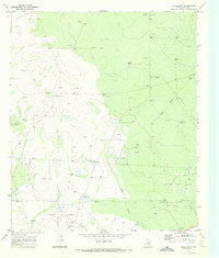
1970 Map of Brunson Ranch
USGS Topo · Published 1972About this map
The high plains along the New Mexico-Texas border are defined here by a sparse network of ranching infrastructure and energy exploration in the early 1970s. The landscape of the Trans-Pecos region is dotted with essential water sources like Indian Springs Windmill and Lehman Windmill, which served the few established outposts such as Brunson Ranch. This 1970 survey captures the area during a period of transition, where traditional cattle ranching coexisted with a growing industrial presence. The sheet is marked by numerous Drill Holes and Gravel Pits, alongside a prominent system of Pipelines that cut across the terrain. These features reflect the dual nature of the economy in Loving County, where the pursuit of groundwater for livestock met the subterranean demands of the oil and gas industry.
Find a feature on this map
11 named features on this map. Tap any name to fly to it.
Don’t see what you’re looking for? This feature index may not catch every label — zoom into the map to look around manually.
Map Details
Editions of this 1970 Brunson Ranch Map
This is the sole edition of this map. No revisions or reprints were ever made.
Other maps of this area

1954 · Hobbs
USGS Topo · 1:250,000

1954 · Pecos
USGS Topo · 1:250,000

1957 · Pecos
USGS Topo · 1:250,000

1958 · Hobbs
USGS Topo · 1:250,000

1969 · Cheyenne Draw SW
USGS Topo · 1:24,000

1969 · Rudd Draw NE
USGS Topo · 1:24,000
1969 · Rudd Draw
USGS Topo · 1:24,000

1970 · Cheyenne Draw
USGS Topo · 1:24,000

1970 · Cheyenne Draw SE
USGS Topo · 1:24,000

1973 · Javelina Basin
USGS Topo · 1:24,000