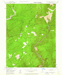
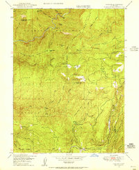
1947 Map of Brush Creek
USGS Topo · Published 1963About this map
Brush Creek serves as a central point in this mid-century topographic survey of the Feather River canyon country, where small settlements and isolated ranches are scattered across the high ridges. Named ranching sites like Hinton Ranch, Zink Ranch, and Andy Smith Ranch suggest a landscape defined by livestock and subsistence, while the Ranger Sta near Brush Creek indicates the ongoing management of the Plumas National Forest.
Find a feature on this map
89 named features on this map. Tap any name to fly to it.
Don’t see what you’re looking for? This feature index may not catch every label — zoom into the map to look around manually.
Map Details
Editions of this 1947 Brush Creek Map
This is the sole edition of this map. No revisions or reprints were ever made.
Other maps of this area

1888 · Bidwell Bar
USGS Topo · 1:125,000

1891 · Bidwell Bar
USGS Topo · 1:125,000

1893 · Bidwell Bar
USGS Topo · 1:125,000

1895 · Bidwell Bar
USGS Topo · 1:125,000

1897 · Bidwell Bar
USGS Topo · 1:125,000
1947 · Bidwell Bar
USGS Topo · 1:24,000

1948 · Big Bend Mtn
USGS Topo · 1:62,500
1948 · Mooreville Ridge
USGS Topo · 1:62,500
1948 · Las Plumas
USGS Topo · 1:24,000
1948 · Cascade
USGS Topo · 1:24,000