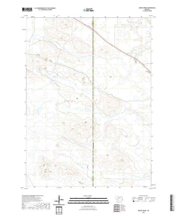
2021 Map of Brush Creek
USGS Topo · Published 2021About this map
Ainsworth Canal cuts across the northern Sandhills landscape, reflecting the long-term water management strategies essential to this part of the Nebraska plains. This 2021 survey shows a terrain defined by subtle drainage networks, where the Cowboy Trl follows a decommissioned rail corridor through the high country. To the west, Leach Lake serves as a prominent landmark in an area otherwise characterized by the winding headwaters of several critical streams. The map documents the intricate paths of Cedar Cr and Brush Cr, alongside the branching tributaries of the Plum Creek system, including the N Fork Plum Cr and South Fork Plum Creek. Positioned along the Cherry County and Brown County line, the region remains primarily defined by large-scale agricultural divisions and isolated ranch roads such as Beel Rd.
Find a feature on this map
17 named features on this map. Tap any name to fly to it.
Don’t see what you’re looking for? This feature index may not catch every label — zoom into the map to look around manually.
Map Details
Editions of this 2021 Brush Creek Map
This is the sole edition of this map. No revisions or reprints were ever made.
Other maps of this area

1949 · Long Lake
USGS Topo · 1:62,500

1950 · Wood Lake
USGS Topo · 1:62,500

1950 · Arabia
USGS Topo · 1:62,500

1951 · Long Lake
USGS Topo · 1:62,500

1951 · Moon Lake
USGS Topo · 1:62,500

1957 · Valentine
USGS Topo · 1:250,000

1959 · Valentine
USGS Topo · 1:250,000

1985 · Wilson Valley
USGS Topo · 1:24,000
1985 · Brush Creek
USGS Topo · 1:24,000
1985 · Arabia SE
USGS Topo · 1:24,000