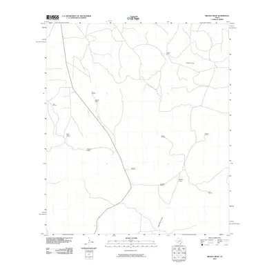
2010 Map of Brushy Draw
USGS Topo · Published 2010About this map
Water management dominates this arid landscape in Val Verde County, where a network of ephemeral watercourses and vital infrastructure supports the ranching economy. Central to the map is the intersection of several significant drainages, including Noelke Draw, Brushy Draw, and Middle Draw, which channel seasonal runoff through the region. The infrastructure reflects the challenges of this terrain, with numerous named water-pumping landmarks such as the Noelke Windmill and Bullhead Windmill scattered across the land.
Find a feature on this map
14 named features on this map. Tap any name to fly to it.
Don’t see what you’re looking for? This feature index may not catch every label — zoom into the map to look around manually.
Map Details
Editions of this 2010 Brushy Draw Map
This is the sole edition of this map. No revisions or reprints were ever made.
Other maps of this area

1954 · Sonora
USGS Topo · 1:250,000

1958 · Sonora
USGS Topo · 1:250,000

1967 · Flat Rock Draw SW
USGS Topo · 1:24,000

1967 · Shafter Draw
USGS Topo · 1:24,000

1969 · Wild Horse Canyon
USGS Topo · 1:24,000

1970 · Juno
USGS Topo · 1:24,000

1970 · Indian Draw
USGS Topo · 1:24,000

1970 · Bee Canyon
USGS Topo · 1:24,000

1970 · Brushy Draw
USGS Topo · 1:24,000
1970 · Harrell Canyon
USGS Topo · 1:24,000