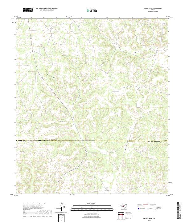
2022 Map of Brushy Draw
USGS Topo · Published 2022About this map
Brushy Draw and its network of ephemeral watercourses define this remote expanse of West Texas, where the landscape is carved by deep drainage systems like Noelke Draw and Jackson Draw. This modern topographic study reveals a terrain of significant elevation changes, most notably at Cedar Bluff Canyon, where the topography drops sharply toward the canyon floor. The map documents the political boundary between Crockett Co and Val Verde Co, a line that cuts through the southern portion of the quadrangle. Human presence is limited to the corridor of State Highway 163 and a few secondary routes like Co RD 102, reflecting a territory where natural landforms take precedence over settlement. This survey provides a precise accounting of the Middle Draw and surrounding ridges as they appeared in 2022.
Find a feature on this map
9 named features on this map. Tap any name to fly to it.
Don’t see what you’re looking for? This feature index may not catch every label — zoom into the map to look around manually.
Map Details
Editions of this 2022 Brushy Draw Map
This is the sole edition of this map. No revisions or reprints were ever made.
Other maps of this area

1954 · Sonora
USGS Topo · 1:250,000

1958 · Sonora
USGS Topo · 1:250,000

1967 · Flat Rock Draw SW
USGS Topo · 1:24,000

1967 · Shafter Draw
USGS Topo · 1:24,000

1969 · Wild Horse Canyon
USGS Topo · 1:24,000

1970 · Juno
USGS Topo · 1:24,000

1970 · Indian Draw
USGS Topo · 1:24,000

1970 · Bee Canyon
USGS Topo · 1:24,000

1970 · Brushy Draw
USGS Topo · 1:24,000
1970 · Harrell Canyon
USGS Topo · 1:24,000