
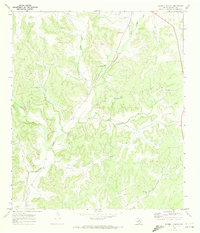
1970 Map of Brushy Draw
USGS Topo · Published 1973About this map
The boundary between Crockett Co and Val Verde Co cuts through this high desert ranchland, where the economy of the early 1970s is defined by a sparse network of livestock infrastructure and energy exploration. Water management is the primary visible imprint on the landscape, evidenced by a series of named water features including the Post Office Windmill, Bullhead Windmill, and the Noelke Windmills. These localized landmarks, often named for families or specific functions, served as critical hubs for the Baggett Ranch and surrounding operations.
Find a feature on this map
20 named features on this map. Tap any name to fly to it.
Don’t see what you’re looking for? This feature index may not catch every label — zoom into the map to look around manually.
Map Details
Editions of this 1970 Brushy Draw Map
This is the sole edition of this map. No revisions or reprints were ever made.
Other maps of this area

1954 · Sonora
USGS Topo · 1:250,000

1958 · Sonora
USGS Topo · 1:250,000

1967 · Flat Rock Draw SW
USGS Topo · 1:24,000

1967 · Shafter Draw
USGS Topo · 1:24,000

1969 · Wild Horse Canyon
USGS Topo · 1:24,000

1970 · Juno
USGS Topo · 1:24,000

1970 · Indian Draw
USGS Topo · 1:24,000

1970 · Bee Canyon
USGS Topo · 1:24,000
1970 · Harrell Canyon
USGS Topo · 1:24,000

1973 · White Draw NW
USGS Topo · 1:24,000