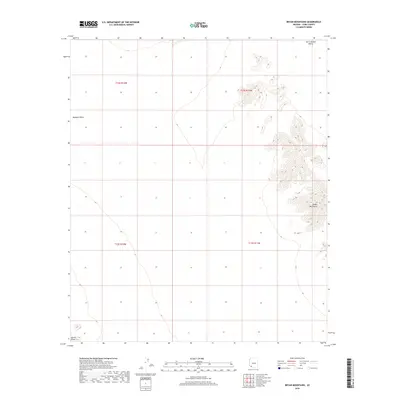
2018 Map of Bryan Mountains
USGS Topo · Published 2018About this map
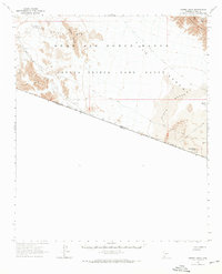
The Bryan Mountains dominate the eastern expanse of this quadrangle, rising sharply from the surrounding desert floor. This 2018 survey documents a largely undeveloped landscape where the steep, rocky ridges of the mountains transition into the broad, flat expanses of the Mohawk Valley to the west and the San Cristobal Valley to the northeast. To the far southwest, the northern tip of the Sierra Pinta emerges, indicating the complex topography of the Yuma County desert. The map provides a clear look at the Public Land Survey System divisions, specifically t12s r12w, t12s r11w, t13s r12w, and t13s r11w, which define the administrative grid of this arid region. The lack of roads or established settlements emphasizes the character of this protected landscape, preserved as part of the Southwest's desert wilderness.
Find a feature on this map
8 named features on this map. Tap any name to fly to it.
Don’t see what you’re looking for? This feature index may not catch every label — zoom into the map to look around manually.
Map Details
Editions of this 2018 Bryan Mountains Map
This is the sole edition of this map. No revisions or reprints were ever made.
Other maps of this area

1953 · Ajo
USGS Topo · 1:250,000

1957 · Ajo
USGS Topo · 1:250,000

1958 · Ajo
USGS Topo · 1:250,000

1962 · Ajo
USGS Topo · 1:250,000

1963 · Ajo
USGS Topo · 1:250,000
1965 · O'Neill Hills
USGS Topo · 1:62,500
1965 · Granite Mountains
USGS Topo · 1:62,500
1965 · Isla Pinta
USGS Topo · 1:62,500
1965 · Sierra Arida
USGS Topo · 1:62,500
1967 · Ajo
USGS Topo · 1:250,000